Category: Blue Ridge Parkway Waterfalls, Lakes & Streams

Wooded trail

MP 271.9 – Cascades Overlook & Trail

The easy, 1-mile loop reveals views from two overlooks along the trail, a bridge over Falls Creek, Cascade Falls and a stream. Please be careful around the falls and do not venture off the trail or climb the walls. The Cascades overlook area also offers a large number of picnic tables. Public restrooms and trash disposal are available at this stop. Trails: Cascades Trail Views: Views from trail of Cascade Falls Picnic Tables: Yes Camping: No

Read More »

MP 316.4 – Linville Falls, Campground & Hiking Trails

Discover a series of waterfalls that drop to a deep gorge, hiking trails with incredible views, a campground, a visitor center, and a picnic area along the Linville River. The trails range from easy to strenuous. The various trails here include the short walk up Duggers Creek and more strenuous hikes into the plunge basin. Follow the access road from the Blue Ridge Parkway to get to the public parking area. The portion of the river along Spur Road is very popular for trout fishing. The campground is located right along the river bank. Parking is at the visitor center which features gifts and accessories, and offers restrooms, water fountains, and information about both the Falls and the Parkway. Trails start at the visitor center. The shortest is to Duggar’s Creek Falls, a small but beautiful waterfall in a lush cove. Other moderate trails lead to views of the main falls and gorge. The falls are impressive, especially the lower falls, as a massive volume of water rushes into the steep gorge. The plunge basin trails take hikers down into the gorge to areas along the river at the base of the falls. Linville Falls is adjacent to the Linville Gorge Wilderness Area, maintained by the US Forest Service. Primitive trails (not shown below) are available for adventurous hikers in the Wilderness Area, and all are rated very strenuous. Dispersed camping is available in the Wilderness Area and requires permits on certain days. Trails: Yes Views: Upper and Lower falls views accessed by trails Picnic Tables: Yes Camping: Yes Features: Waterfall

Read More »
boone fork trail

MP 296.5 – Boone Fork Trail & Falls

The Boone Fork Trail is a moderate 5.2-mile hike that traverses streams and goes through tunnels of rhododendron. The path is incredibly varied, with multiple stream crossings, boardwalks over boulders, pastures filled with wildflowers, and views of beautiful waterfalls.  In fact, Hebron Falls can be accessed about 1 mile down the trail (head to the right from the trailhead). This trail is a favorite for many locals! The trailhead is located at the Price Park Picnic Area, which has plenty of parking and lots of picnic tables. Public restrooms are available at the trailhead as well. Trails: Boone Fork Trail – moderate Views: Waterfall, meadow, streams Picnic Tables: Yes Camping: No

Read More »
Sim's Creek bridge

MP 295.3 – Sims Creek Overlook & Green Knob Trail

Sims Creek Overlook is a great access for the Green Knob Trail, a 2.3-mile loop. From the overlook parking area, a set of steps leads to the trail, first passing directly through dense thickets of rosebay rhododendron. It’s a fantastic spot to view this particular rhododendron bloom, which usually peaks in the Blowing Rock area around late June to early July. The trail itself is varied, going under the bridge and through pastures, along Sims creek, and through forests. The trail nears the top of Green Knob, so there are some sections of the trail with long climbs. The Sims Creek bridge is an excellent spot for fall color viewing, with a pedestrian sidewalk on each side. The view is a close one, but packed with a variety of deciduous trees growing along the banks of the creek. Trails: Green Knob Trail Views: View of Sims Creek Bridge, pastoral views along trail Picnic Tables: No Camping: No

Read More »
Price Lake at Julian Price Park on the Blue Ridge Parkway

MP 297 – Julian Price Memorial Park

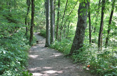
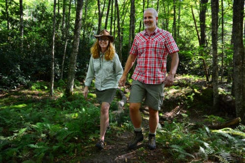
Enjoy 4,200 acres of rolling mountains with elevations ranging from 3,400 to nearly 4,000 feet, plus a lake, stream, hiking trails, and a campground at Julian Price Memorial Park on the Blue Ridge Parkway at Milepost 297. Julian Price was an insurance executive in the early 1900s who prospered as a principal developer of the Jefferson Standard Life Insurance Company, which later became Jefferson-Pilot Life Insurance Company. Price purchased the 4,200 acres in the 1930s to provide a recreation area for his employees. When he died in 1946, his heirs left the land to the Blue Ridge Parkway as a memorial to him. Directly adjacent to the Moses H. Cone Memorial Park, together the two parks comprise the largest developed area set aside for public recreation on the Parkway. Price Park is home to the largest campground on the Parkway and is a popular picnic spot. Visitors enjoy interpretive programs, fishing, canoe and kayak rentals at Price Lake, and an extensive trail system. Trails: Green Knob Trail, Boone Fork Trail, Mountains-to-Sea Trail, Price Lake Trail, Tanawha Trail Views: Lake, mountain, stream, and meadow views Picnic Tables: Yes Camping: Yes Other Features: Canoe & kayak rentals      Price Lake Formed in the 1940s by damming up Boone Fork Creek, the focal point of Julian Price Memorial Park is the 47-acre Price Lake. The Lake offers fishing, canoe, single and double kayak, and paddleboard rentals, a 2.5-mile hiking loop around the lake, and a 300 seat amphitheater for interpretive programs. The picturesque lake is set against the backdrop of Grandfather Mountain with a view of Calloway Peak. Price Lake is open to fishing for anyone with a valid Virginia or North Carolina fishing license. Swimming is not allowed. HIKING TRAILS Boone Fork Trail Green Knob Trail MODERATE 2.3 miles, loop Dogs allowed on leash Start at Sim’s Pond Parking Area, (milepost 295.9) Leads to the top of Green Knob and a distant view of Price Lake followed by a view of Calloway Peak on the horizon. Boone Fork Trail MODERATE TO STRENUOUS5.5 miles, loopDogs allowed on leash   Access the trail at the wooden footbridge in Price Park Picnic area (milepost 296.4). Trail features streams, pastures, rock outcrops, meadows, and shaded forest.         Price Lake Loop Trail Price Lake Trail EASY2.7 miles, loopDogs allowed on leash Access this trail from the Price Lake Overlook (milepost 296.7) or the Boone Fork Overlook (milepost 297.1). This trail circles the shoreline of 47-acre Price Lake.  Tanawha Trail EASY TO MODERATE13.5 milesDogs allowed on leash The 13.5-mile Tanawha Trail leaves Boone Fork Trail near Price Park Campground. Wander through fields and by streams, skirting the flanks of Grandfather Mountain, ending at Beacon Heights (milepost 305.5). Parking and access for the Tanawha Trail in Price Park are available at the Boone Fork Overlook (milepost 297.1).  Boone Fork Trail The Mountains-to-Sea Trail The Mountains-to-Sea Trail runs jointly with the Boone Fork Trail for half its length. Signs indicate entry and exit points. The Mountains to Sea Trail stretches 1,175 miles from the Great Smoky Mountains to the Outer Banks.   Picnicking Over 100 picnic sites are available and restrooms are available seasonally. Sites and restrooms are wheelchair accessible with assistance. Camping Price Park Campground has 129 tent sites and 68 RV sites. Sites on Loop “A” are located near Price Lake. Reservations can be made for portions of this campground online at www.RECREATION.gov or by calling 1-877-444-6777. One backcountry campsite requiring a hike is available, and a permit must be obtained from the campground during the season. For more information, call 828-963-5911 or 828-295-7591. During the summer, rangers present programs on various topics at the amphitheater located in the campground.

Read More »